'You are Here' opened with maps of exactly where exhibition visitors were standing: the National Library of Scotland on George IV Bridge, in the centre of Edinburgh.
Maps of the city bring to life Edinburgh's rich history, changing streets and varied architecture.
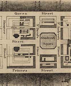
Building Edinburgh's New Town

John Ainslie's plan, dating from around 1780, shows designs for Edinburgh's New Town. Considered an excellent example of city planning, the area was built in stages between 1767 and 1850.
This plan pre-dates the construction the Mound, which today links the new and the old parts of the city. Plans such as this give a fascinating insight into the way a city changes over time.
Ainslie (1745-1828) was a surveyor and cartographer known for his accurate renderings of Scotland and its islands.
Edinburgh and Leith

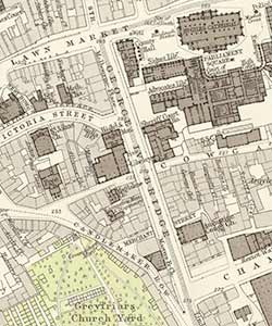
Mapmaker J C Bartholomew (1923-2008) described 1891's 'Plan of the city of Edinburgh with Leith and suburbs' as '[John Bartholomew & son's] finest engraved town plan'.
Based on Ordnance Survey information and supplemented by data from the city surveyor, the map is a good example of a large scale town plan.
The map shows the location of the National Library of Scotland on George IV Bridge — however, the Library was not yet built when the map was made in 1891.
John Bartholomew & Son Ltd was an Edinburgh-based firm of map engravers, printers and publishers. They operated from 1820 to 2002.
Learn more about John Bartholomew & Son in the Library's Bartholomew Archive
Maps of Edinburgh were on show in 'You are Here', our exhibition on maps, which ran at the National Library from 22 July 2016 to 17 April 2017.
