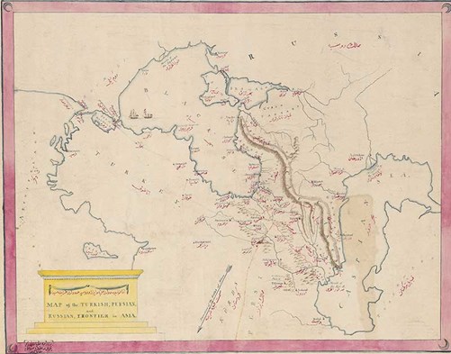

This is a hand-drawn map of the Turkish, Persian and Russian frontiers in Asia. [Library shelfmark: MS.5719].
Likely to date from the end of the 18th century, it shows Turkey, the Black Sea and the Russian and Persian frontiers of the region. Place names on the map are in both English and Ottoman Turkish. There are symbols for mosques and churches, and it shows the land of the Kurds and the direction of Mecca. It measures distance in units of 20 hours' travel.
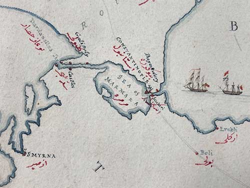
Details in the second image include the locations of Constantinople, Gallipoli and Smyrna. The map belonged to the diplomat Robert Liston. Robert first served as Ambassador Extraordinary to the Sublime Porte from 1794 to 1795 and then again as Ambassador from 1812 to 1820.
