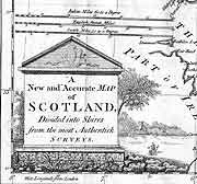
The Scottish Maps Forum was established by the National Library in January 2002 to develop the interest in early maps of Scotland generated by Project Pont. The forum is led by an invited steering committee of researchers, map users and representatives of institutions with map collections.
The aims of the forum are:

- To stimulate and to encourage multi-disciplinary map use, study and research, particularly relating to Scottish maps and mapmakers
- To disseminate information on Scottish maps and map collections
- To record information on maps and mapmaking, particularly in a Scottish context
- To liaise with other groups and individuals with map related interests
- To build on, and to continue, the work of Project Pont.
Events
The forum organises seminars and other map-related activities. You can find out more about upcoming events featuring maps by visiting our What's On page. Watch past events about maps via the National Library of Scotland's YouTube channel.
- 3 May 2024 — Seminar at the National Library of Scotland at Causewayside in Edinburgh. 'The Premodern Scottish Place'.
- 15 May 2020 — Seminar at the A.K. Bell Library, Perth. 'Maps and 'The Three Rs': Rescue, Revelation and Research relating to early maps of Scotland'. View 'Maps and 'The Three R's' seminar programme and booking form (PDF) (674 KB; 2 pages)
- 20 April 2018 — Seminar at the National Library of Scotland at Kelvin Hall, Glasgow. 'Constructing the paper landscape: Recent research in historical maps of Scotland'
- 31 March 2017 — Seminar at the National Library of Scotland, George IV Bridge. 'Old maps and new directions: Recent research in historical maps of Scotland'
- 12 May 2012 — Seminar at the A K Bell Library, Perth. 'Mapping and printing the world: Scottish milestones in 19th century publishing'
- 7 May 2011 — Seminar at the AK Bell Library, Perth. 'Routes across the map - cartography, travel and transport'
- 27 October 2009 — Seminar at the National Library of Scotland, Causewayside Building: 'Mapping and Antiquities in Scotland'
- 22 April 2008 — Seminar at the National Library of Scotland, Causewayside Building: 'Planning the Scottish townscape? Exploring urban history through town plans'
- 4 April 2007 — Seminar at Blair Castle: 'Landscape in the Age of Improvement: estate plans and landscape change in Scotland'.
- April 2006 — Seminar: 'Muskets and mapping: military engineers and maps in Jacobite Scotland'
Explored the role of military engineers in 18th-century Scotland and the maps and plans they produced - September 2004 — Seminar: 'Look at Scotland and enjoy a feast for the eyes!'
A seminar to celebrate the 350th anniversary of the publication of volume 5 of of Blaeu's 'Atlas Novus' (1654), effectively Scotland's first atlas - October 2003 — Seminar: 'Scotland Illustrated: mapping and picturing the nation 1680-1720'
- October 2002 — Seminar: 'Maps and Local History' (in conjunction with the Scottish Local History Forum)
- June 2002 — Field excursion, Timothy Pont's Fife', to Culross, St Andrews and Scotstarvit.
Cairt

A free newsletter, 'Cairt', is issued twice a year. ('Cairt' is Gaelic and 17th-century Scots for 'map'.) Recent issues of Cairt are available as PDF files.
If you wish to be added to the mailing list to receive the 'Cairt' newsletter and information about events, contact maps@nls.uk.
